%20small.png)
Translating Pole Data
- Adam Schmehl
- Aug 13, 2018
- 3 min read
Updated: Apr 4, 2023

I've had a chance to both observe and assist in a multitude of projects that our team has taken on over the past year. In this time, my team has worked with pole data from 15 states and supported software subscribers across the US and Canada.
Though the scopes for these projects are ever-changing, there has always been one constant: Katapult Pro.
We don't use hot sticks or CADD, instead delivering dynamic and interactive maps with height data overlays.

Our field crews--composed of a wide range of interns, coders, project managers, and even our Chief Operating Officer--can quickly collect much of the data needed over a couple days, then finish processing the data in the office or remotely for the rest of the week.
Field collection using the Katapult method is simple, safe, and speedy. New team members are usually comfortable holding the height stick and taking photos at the pole within their first few hours in the field.

Across the street, the SLR operator should have a bit more experience, especially when navigating tricky designs and guying situations that may require additional data collection. Though this position takes longer to master, it can still be learned within a few hours. Once the photos are back in the office, our remote processors begin the data translation process.
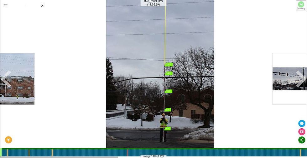
Each photo is tagged using simple keyboard shortcuts to efficiently categorize thousands of pole photos. During this step, height shots are calibrated so that attachment and midspan heights can be added to the photo with just a click of the mouse. In a matter of hours, a mountain of photos is effectively translated into meaningful data ready to be analyzed.
In the field, the SLR operator was indicating when they were taking pictures of each pole, which means that our thousands of photos are instantly associated to the correct location in the job's design. If they marked something wrong in the field, our software highlights the association error allowing all mistakes to be remedied quickly.

With all the photos calibrated and associated correctly, it's time for the real fun to begin. By measuring attachment and equipment heights in each pole height photo, we create labels that our software interprets to export to permitting sheets, pole loading software, and more.

These labels help us visualize all the elements that exist on a pole, but they also serve a much greater purpose. These labels are our way of translating pole data into a universally valuable format.
If you need to take the data into Pole Foreman, SPIDACalc, O-Calc or EZ Load, you can do so straight from Katapult Pro. You can also download custom spreadsheets for permitting and make ready with the click of a button.

Open your downloaded file in Pole Foreman to see a complete translation of your data in the new platform of your choice.

Translating data from our universal software allows us great flexibility. Someone familiar with Katapult Pro can perform high volumes of permitting, loading, make ready, or even take a stack of scanned pole profile sheets and load them into SPIDA or O-Calc with ease.
Whether you need to call make ready, perform loading analysis, or just apply for third party attachments, our software can make it quick and simple for you and your team. If you'd like to learn more about our new Make Ready Tool, or just need some help completing a project with high volumes of loading, contact us at 717-432-0716, or email me at aschmehl@katapultengineering.com


Comments